View All
Bozeman Real Estate Market
Development
Bozeman Business
Bozeman Neighborhoods
Get Outside
Moving to Bozeman
Retiring in Bozeman
Just for Fun
The Selling Side
The Buying Side
Bozeman Nonprofits
Affordable Housing
Community Events
Living in Bozeman
Belgrade Real Estate
Livingston Real Estate
Manhattan Real Estate
Three Forks Montana Real Estate
Big Sky Real Estate
Moving to Montana
Home Ownership
Living in Montana
Bozeman Real Estate Group
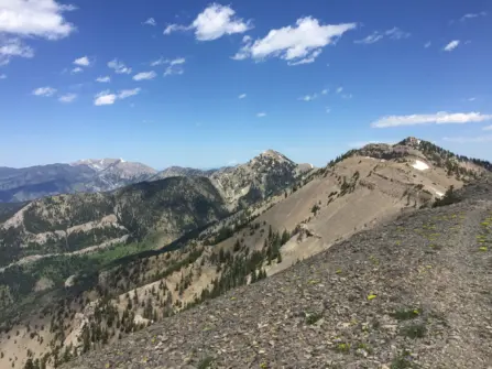
With six mountain ranges surrounding Bozeman it's not hard to find a mountain to climb, it's just hard to decide which one! Here's our list of the best peaks to climb near Bozeman, Montana this summer.

Baldy Mountain
8 miles round trip | 4,300 feet
As one of the most noticeable peaks in the Bridger Mountains, Mount Baldy just waiting to be climbed. Standing at 8,914 feet*, Mount Baldy is far from the tallest point in the Bridgers but from Bozeman it appears as the most prominent.
Hiking Directions: Starting at the “M” trail, follow the trail past the M as the trail steadily climbs continuing through the trees to a rocky outcrop. Continue on the steep trail through the forest until you come to a meadow as the ridge starts to flatten out. Allow your legs to enjoy the break until you reach the final push, climbing up the ridge as it turns to rocky scree which means you are almost there! Beware of the false summit, but don’t worry, the actual peak is not far from there.
Other options to reach the top are from Sypes Canyon Trail (we’ve never done it this way but we hear it is really steep!), from Bridger Bowl, Middle Cottonwood Creek or as part of the Bridger Ridge hike which begins at Sacajawea Peak, runs the entire length of the Bridger Mountains and ends at the M trail.

Naya Nuki Peak
4.8 miles round trip | 1,935 feet
Located just slightly south of one of Bozeman’s most popular peaks to hike, Sacagawea, Naya Nuki sits at 9,449 feet and offers beautiful views of the Bridger Mountain Range as well as the sprawling land to the east and west. There’s a more than likely chance you will spot mountain goats up here as well! Just be careful, the ridge of the Bridger Range is notoriously windy.
To get there: Drive up Bridger Canyon turning left onto Fairy Lake Road. The road is rough, but most cars can manage. Drive until you reach Fairy Lake Campground and look for the trailhead at the end of the road. The trail maintains a steady climb until you reach the cirque. Your legs get a little break as you walk towards the switchbacks that take you up to the saddle. Continue to the left as you follow the trail just below Sacajawea Peak. Follow the trail as it skirts the ridge, coming just below Naya Nuki peak. From here it’s a little scramble on a faint trail to the top.

Hyalite Peak
16.2 miles round trip | 4,045 feet
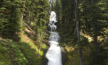
Known as the most beautiful hike in Bozeman, the trail to Hyalite Peak leads you past 11 waterfalls to the dramatic basin that holds Hyalite Lake, eventually continuing on to the top of Hyalite Peak which boasts views of Paradise Valley, Yellowstone, Big Sky and Gallatin Valley.
Hiking Directions: Starting at the Grotto Falls trailhead, take the fork to the left. This fork bypasses Grotto Falls and heads up the canyon. The trail is moderate to easy for the first 3 miles, with many stops for waterfalls on the way. After a few miles, the trail starts to climb up maintaining a moderate grade. Eventually you will come to a bridged creek crossing which leads to the basin where Hyalite Lake sits. Take a rest by the lake, enjoying the dramatic mountain backdrop and then continue on the trail that wraps around the West side of the lake. From here the trail gets difficult, climbing up and eventually switch backing to the saddle. From here it’s a smooth but steep climb to the top of Hyalite Peak.

Blackmore Peak
10 miles round trip | 3,540 feet
With a trailhead that starts just before Hyalite Reservoir, this is a great Bozeman peak to climb if you don’t want to spend a lot of time driving! The hike is moderately difficult but it is such a beautiful trail, and of course, the views are fantastic! From Blackmore Peak you can enjoy stunning views in every direction including a great view of Hyalite Reservoir below, as well as the Bridger Mountains in the distance.
Hiking Directions: From the Blackmore Lake Trailhead, the first stop on the hike is Blackmore Lake (approximately 2 miles from the trailhead) which can be a bit underwhelming depending on the season. Either way, it’s a wonderful place to stop and rest up as the hike gets a bit more difficult from here. After the lake, the hike begins to climb, steeply, through the forest. The majority of the hike continues like this as you eventually climb your way to an open meadow where you will notice a few primitive campsites. At the south end of the meadow, switchbacks bring you to the saddle. There is an option to scramble up Elephant Mountain to the East, otherwise continue to follow the trail to the West on the final stretch to the summit of Blackmore Peak.

Storm Castle
5.2 miles round trip | 1,850 feet
With 1,850 feet of elevation gain, this hike is the easiest on the list but offers an impressive view of Gallatin Canyon and the surrounding mountain ranges. The hike follows switchbacks up a south-facing hill up to the top of Storm Castle Rock. There are two great lookouts at the top. One is through an arched rock formation that beautifully frames the mountains in the distance, the other is at the top of Storm Castle Rock. We will warn you, there's not a lot of space on top of Storm Castle Rock and there are steep drops below, so if you are bringing children or pets, please be careful!
Hiking Directions: From Bozeman take Hwy 191 South towards Big Sky and drive approximately 16 miles. Take a left on Storm Castle Road. Continue 2 miles to the marked parking area and trailhead. The hike begins with switchbacks that will take you up the mountainside. Some of the trail is forested, but much of it is exposed so it can be hot in the summer. The switchbacks get tighter as you near the top, there are some rocky areas but please stay on the trail! The final stretch takes you over to the north side of the mountain through a wooded area, eventually leading to the lookouts mentioned above.

Emigrant Peak
7.6 miles round trip | 5,021 feet
A relentless, but awesome peak to climb. If you have ever climbed Emigrant Peak, you will know exactly what we mean. The 5,021 foot climb begins within minutes of hitting the trail and continues straight up the mountain to the top. But at the top you are rewarded with the most amazing views of the Absaroka Range on one side and Paradise Valley on the other. It’s well worth the struggle if you are up for it!