View All
Bozeman Real Estate Market
Development
Bozeman Business
Bozeman Neighborhoods
Get Outside
Moving to Bozeman
Retiring in Bozeman
Just for Fun
The Selling Side
The Buying Side
Bozeman Nonprofits
Affordable Housing
Community Events
Living in Bozeman
Belgrade Real Estate
Livingston Real Estate
Manhattan Real Estate
Three Forks Montana Real Estate
Big Sky Real Estate
Moving to Montana
Home Ownership
Living in Montana
Bozeman Real Estate Group
Spring hiking in Bozeman, Montana can be a bit tricky. Many forest service roads are closed this time of year which makes accessing some of Bozeman's most popular hikes difficult. On the trail, you can encounter a range of conditions, including dry, muddy, and icy terrain, often all within the same hike! However, you also get quiet trails before tourist season hits! Here's our list of the best spring hikes in Bozeman.
1. Sourdough Canyon
Description: This is a popular trail because of its close proximity to Bozeman. You can easily head to Sourdough Canyon trail for a before or after work jaunt, and the hike can be as long or short as you want it. This trail gets used by trail runners, bikers, families with strollers, and everything in between. The trail is nice and wide and follows the Bozeman Creek, which fun fact, is the source of a good portion of Bozeman’s drinking water! The stream also offers several great spots to wade in and cool off on a hot day. You can go the full ten miles to Mystic Lake or turn around at any point.
Difficulty: Easy to moderate.
Directions/Parking: South on 19th, east on Nash Road, South on Sourdough Canyon Road to the parking lot.
2. Chestnut Mountain
Description: Head just east of Bozeman for this quiet hiking trail (once you get past the interstate noise that is!) This trail is most commonly used for climbers heading to Frog Rock, and if you’re lucky you’ll get to catch some of them in action. The climb starts right away with switchbacks so it won’t take long to feel like you are high up in the mountains. After a couple of miles, views of Frog Rock will make an appearance and you’ll be able to see back towards Bozeman. This can be a great turnaround spot if you’re looking for a quick hike. Otherwise, continue to the top of Chestnut Mountain which is just over 6.5 miles from the trailhead.
Difficulty: Moderate to difficult, steep in places with plenty of switchbacks
Directions/Parking: Take I-90 to the Trail Creek exit. Head east on Trail Creek Road and you’ll reach the Chestnut Mountain trailhead parking on the south side of the road
3. Bear Canyon
Description: This trail can be muddy, but it’s totally worth it. The trail follows Bear Creek all the way up to Bear Lakes. You are near the water for the majority of the hike and there isn’t much elevation gain which makes it a fairly easy and enjoyable hike. A couple of miles in, there’s a loop you can make, or if you want to head all the way to Bear Lakes, the hike ends up being just over 8 miles out and back.
Difficulty: Moderate
Directions: Off of I-90 take the Bear Canyon exit, head west, and then south on Bear Canyon Road. Proceed all the way to the end of the road (there is a trailhead for New World Gulch first, keep going a little further.)
4. Truman Gulch
Description: This hike is popular with mountain bikers, but don’t let that discourage you! The views are great and there are a lot of route options as the trail connects with the Bridger Foothills Trail. There’s water this time of year, mountain meadows, and if you time it right, plenty of wildflowers to enjoy. There are some switchbacks and the hike is around 3 miles round trip.
Difficulty: Moderate
Directions: North on Springhill Road for 8.5 miles to Springhill Community Road. There’s a sign for Truman Gulch, turn right and continue for 1.6 miles to Walker Road. Turn right after Springhill Church and drive 1.1 miles to Forswell Road and continue 3 miles to the trailhead.
5. Sypes Canyon
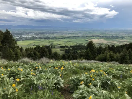
Description: Over in the Bridger Foothills, the Sypes Canyon trail is always bursting with wildflowers in the spring! The trail follows a seasonal stream, goes in and out of the forest, and ends with an overlook at the two-mile mark that offers spectacular views of the valley. It connects with the Bridger Foothills trail so if you want to hike further you can continue along the ridge all the way to Mount Baldy and then down the M trail. This is a popular trail because it’s easy to get to. Parking can get a little crowded and because the trailhead is in a neighborhood, be sure to be respectful of where you leave your car.
Difficulty: Easy to moderate
Directions: North on Springhill Road to Sypes Canyon and continue until the Y. Bear right and park at the trailhead or in the overflow parking lot. Again, please don’t park where the well-marked no parking signs are.
6. Lava Lake
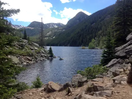
Description: Spring is a perfect time to hit this popular trail before the tourists get here! The trail is rocky and winds through a thick forest with a steady climb the whole way up. Once there, the view is pretty spectacular, with the lake and mountains surrounding it. The lake is most likely still frozen right now but should begin thawing out soon. It’s a 5.5-mile hike round trip with a 1,600-foot elevation gain.
Difficulty: Moderate to difficult
Directions: Hwy 191 south towards Big Sky, the trailhead is well marked. After you pass House Rock start looking for the turn off on the right.
7. Hell Roaring Creek
Description: Located in Gallatin Canyon, the Hell Roaring Creek trail tends to get crowded during the summer months when tourists visit. Therefore, the ideal time to explore this trail is during the spring season. The hike starts by climbing up to a ridge and then dropping down towards Hell Roaring Creek. About a mile in, you cross Hell Roaring Creek and continue to follow the trail along the creek into forested areas eventually opening to meadows throughout. The trail connects with other trails within the Spanish Peaks so you can make the hike as long or short as you feel up to. After the initial climb up the ridge, there is little elevation gain and it is a pleasant, easy trail.
Difficulty: Easy
Directions: Hwy 191 south towards Big Sky, near Montana Whitewater. The trailhead is just off the highway on the right side.
8. Cherry River Pond
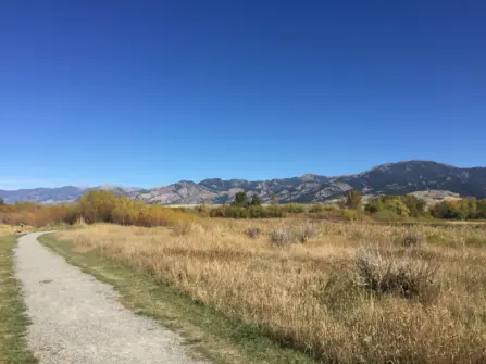
Description: This is an easy in-town trail, with amazing views of the Bridger Mountains. There are a few loops to choose from, and all the trails are flat. When the mountains get a late spring snow, this trail is a good choice to get a little walk in. Even though it is right off Frontage road, it feels peaceful on the trail. This trail requires dogs to be on a leash. It’s a popular spot for fishing access to the East Gallatin River and also can lead over to the East Gallatin Recreation Area (and MAP Brewing if you feel like a break and a beer!)
Difficulty: Easy
Directions: North on North 7th, immediately after the overpass take a quick right to the parking area
9. Gallagator Trail & Peets Hill
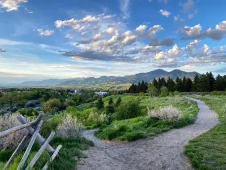
Description: These are also great in-town trails that are part of the Main Street to Mountains trail system. Park at the base of Peets Hill and either head up the trails on the hill, or cross Church Street for the Gallagator Trail and stroll towards the climbing rock and Langohr gardens. These are popular running and biking trails so you certainly won’t be alone on them. A nice walk can be going along the Gallagator, past the climbing rock, through the gardens, and then up to Willson Avenue making your way back through the historic neighborhoods of Bozeman.
Difficulty: Easy
Directions: South on Church from Main Street, the parking lot is on the left immediately after Bogert Park
10. Storm Castle
Description: If you are looking for a view, this is the hike for you! The hike is located in Gallatin Canyon and is a steep but rewarding climb up to the top of the prominent Storm Castle Rock. While this hike can get a little muddy, it is south facing so it dries up quicker than most trails this time of year. This hike is just under 5 miles round trip with 1,850 feet of elevation gain. Please keep in mind that the gate on Storm Castle Road is closed until the middle of May which will add 2 miles to this hike.
Difficulty: Moderate to Difficult
Directions: Hwy 191 south towards Big Sky, left on Storm Castle Road. Continue to the gate parking area or to the trailhead.
Want more?
