View All
Bozeman Real Estate Market
Development
Bozeman Business
Bozeman Neighborhoods
Get Outside
Moving to Bozeman
Retiring in Bozeman
Just for Fun
The Selling Side
The Buying Side
Bozeman Nonprofits
Affordable Housing
Community Events
Living in Bozeman
Belgrade Real Estate
Livingston Real Estate
Manhattan Real Estate
Three Forks Montana Real Estate
Big Sky Real Estate
Moving to Montana
Home Ownership
Living in Montana
Bozeman Real Estate Group

5 Best Hikes in Livingston, Montana
On Aug 01, 2023
Hiking near Livingston and in the Paradise Valley offers some of the best hikes to be found in Southwest Montana. From waterfalls to peaks, you can find something for everyone when you are exploring this area. Please keep in mind that this is bear country. Always bring bear spray when you are hiking in this area and make sure you know what to do if you do encounter a bear. With that in mind, check out this list of the best hikes near Livingston, Montana.
1. Passage Falls
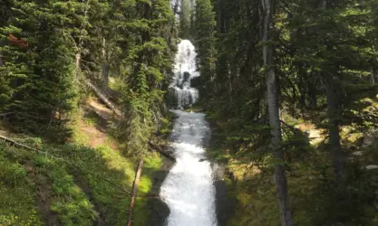
Passage Falls is an easy, 5-mile hike to a beautiful waterfall. The trail remains relatively flat throughout the hike, climbing just 623 feet in total making this the perfect hike for all skill levels. The hike takes you through a forested area that was burned in 2007, past a section of private land, and eventually leads to the Passage Creek waterfall.
Getting there: From Livingston, drive 15.7 miles south on Highway 89 to the Mill Creek intersection on the left. Continue 14 miles up Mill Creek Road to the Wallace Creek trailhead parking area on the right.
2. West Pine Creek
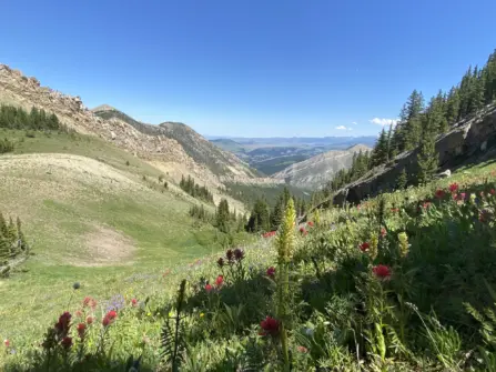
With one of the best views of Paradise Valley, the West Pine Creek Trail is a great 12-mile out-and-back trail. With a 2,647-foot elevation gain, this hike is great for moderate to expert skill levels. This hike begins by switchbacking through a forest that was burned in the 2001 Fridley Fire. After reaching the gate, the trail will wind through meadows and up along a ridge with incredible views of the valley. The cairn at 2.7 miles is a great turnaround point for those who don’t want to go the full 6 miles. At the 4-mile mark, the trail ventures back into the forest, eventually intersecting with the North Dry Divide #135 trail.
Getting there: From Bozeman, drive 7 miles east on I-90 to the Trail Creek Road exit. Turn right onto Trail Creek Road and continue e for 15.2 miles until you reach West Pine Creek Road. Turn right and drive 3.2 miles to the posted fork, follow the road to the left following the signs for the West Pine Trailhead, and continue 1.4 more miles to the trailhead.
3. Pine Creek Falls
The Pine Creek Falls and Pine Creek Lake hikes are arguably the most popular in the area. While they are beautiful, the trail is very busy, particularly in the summer months. The trail begins at the back of the Pine Creek campground and while there is a large parking lot, it can get full quickly. The first 1 ¼ miles of the trail are relatively easy, meandering through a beautiful forest and along Pine Creek until you reach the Pine Creek Falls. If you are brave enough, crossing the bridge brings you to a second smaller waterfall that is just as beautiful as the first. For most, this is the turnaround point. If you plan to continue on to Pine Creek Lake you continue just past the falls where the trail starts to climb. Don’t be deceived by the easy trail to the falls, the rest of the trail is steep and rugged, climbing 3,000 feet in the next four miles.
Getting there: From Livingston drive 9.6 miles to the Pine Creek Road junction. Turn left and drive 2.4 miles to East River Road, turn right and drive .7 miles to the marked turn for the Pine Creek Campground. Turn left and drive 3.1 miles to the campground, continue through the campground until you reach the trailhead parking.
4. Suce Creek
Out of all the trails on this list, the Suce Creek hike is the closest to Livingston. Approximately 6.5 miles with a 1,443-foot elevation gain, this is a great hike for moderate skill levels. The trail weaves its way through the forest before it follows Suce Creek, eventually crossing Suce Creek and meeting Lost Creek. At approximately 3.3 miles, the trail meets a junction where you can continue on to Livingston Peak or complete a full loop back to the Suce Creek trailhead.
Getting there: From Livingston, head south on Highway 89 for 2 miles to East River Road on the left. Follow East River Road for 2.5 miles until you see the turn-off for Suce Creek Road on the left. After 1 mile, follow the road to the right until you hit the trailhead parking area.
5. Elephanthead Mountain
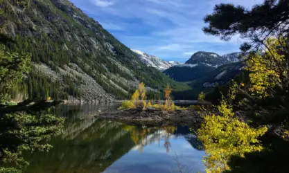
If you are looking for a peak to climb, Elephanthead Mountain is a great hike that ends with stunning views of the valley and the Absaroka Beartooth wilderness. This hike is for moderate to expert skill levels as it climbs more than 3,500 feet to the top. The 10-mile out-and-back trail follows Mission Creek for the first 3 miles while climbing steadily through the forest. The trail officially ends at a 3-way intersection at 5 miles where you can connect with the North Fork Deep Creek trail or the Blacktail Creek Trail. To continue on to the top of Elephanthead it is unmarked, but do your best to be respectful of the vegetation. The approach to the final summit can be challenging due to rocky outcroppings.
Getting there: From Livingston, drive east on US 89 until you see the turn-off for Swingly Road on the right. Continue for 6 miles until you reach Bruffy Lane, follow this road for 1 mile until you reach the 63 Ranch. Turn right toward the ranch and then follow the road to the left through the green gate. This is private property so please be respectful. The road gets rough from here as it continues 1 mile to the trailhead.
Want more?
Moving to Livingston | About Livingston | Livingston Subdivisions


